Introduction
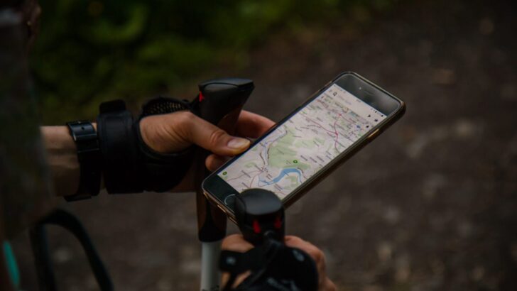
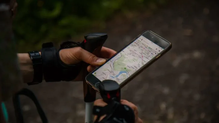
With the advent of the modern smartphone, identifying and navigating a hiking trail has gotten easier and simpler. No longer tied to a physical map, both hikers and campers can identify and navigate their given trail with ease and can review the trail before even embarking on the trip.
However, relying solely on your smartphone for GPS while hiking can be tricky, particularly in the event that you reach a section of the trail without any cell service. Therefore, below, we are going to review how to use your phones GPS while hiking with no cell service.
How Does Your Phones GPS Work?
The GPS system is a technology that was originally developed by the U.S. Navy and is currently owned by the United States government, being overseen by the Air Force. GPS stands for Global Positioning System and is currently a free service.
The GPS system is a radio navigation system. It uses radio waves between satellites and a receiver in your phone to provide accurate location and time information. In fact, your phone doesn’t have to send any data back to these satellites to work.
Rather, your phone simply needs to receive data from four or more of the 28 satellites in orbit that are dedicated for GPS use. As your phone contains an internal chip receiver, it utilizes the data from the satellite signals to triangulate where you are.
Interestingly, although the GPS system is used to triangulate your position, it relies on four satellites to do so. This is because the fourth satellite is used to determine your altitude.
GPS receivers, whether within your phone or via a dedicated GPS device, utilize a lot of power and require unobstructed view of multiple satellites to work correctly. Obstructions, including tall trees, deep canyon valleys, and other objects which could impede a clear view, can cause the GPS system to glitch, and not work correctly.
Lastly, and perhaps most importantly, is that in order for the GPS system in your phone to work correctly, you simply need an unobstructed view to the sky in order to receive signals from four satellites. This means that a GPS signal can be established even without adequate cell signal.


How Does AGPS Work on a Cell Phone?
Due to natural obstructions in the real world, cell phone providers have included AGPS within their devices. AGPS stands for Assisted Global Positioning System. The AGPS is what you are likely using when you use your phones GPS.
Due to the power needed to utilize a GPS system, AGPS adds cellular location data to assist the geolocation. This is done by “pinging” nearby cell towers to determine where you are. Although the precision will depend on the strength of the cellular signal, it is usually good enough to be used for location data.
However, during a hiking or camping trip, you may have limited cellular signal, making the AGPS system effectively defunct for your particular needs.
How to Use GPS Navigation Apps While Hiking Without Cellular Service
As mentioned above, GPS coordinates can be established even without a proper cellular signal. However, acquiring a GPS signal without cellular service will leave you staring at a fuzzy map with little to no additional details about your surroundings.
To counteract this dilemma, we highly recommend downloading a dedicated hiking trail app for offline use. There are a plethora of hiking apps which provide offline use for hiking and camping.
Firstly, we highly recommend downloading offline maps to assist you with getting to, and leaving from, your hike. We recommend utilizing Google Maps, which can be downloaded offline and will provide you with step-by-step directions from your home to the hiking location.


To download Google Maps for offline use, follow the below steps:
- Download the Google Maps app to your phone
- Open the Google Maps app
- Search for the location where you will be hiking
- At the bottom of the search, tap the name of the place you are heading and tap on more
- Select Download offline map > Download
Best Apps for Offline GPS While Hiking
As hikers, we like to always be prepared and never solely rely on one app for GPS directions. The below apps will not only provide you with access to offline maps and GPS capabilities, but they will also show you important waypoints, topo maps, and other important information to assist you while on your hike.
All Trails – All Trails is our editor’s choice for the best hiking and camping app. With over 200,000 detailed trail maps, you can hit the trail with full confidence and preparedness. In addition, with All Trails, you can turn your phone into a GPS tracker and follow the trail with ease.
In addition, with All Trails, you are able to record your pace, distance, elevation, and max speed. If you’d like, you can even share this information with your family and friends. Similarly, with All Trails you can find dog-friendly and kid-friendly trails.
And with an active, healthy audience of over 25 million explorers and hikers, you can read hike reviews and view pictures taken by other hikers.


ToPo Maps+ – ToPo Maps+ is another great hiking and camping app that can be downloaded to your phone for offline use. With high-quality, detailed map topographic details, you’ll be able to add definition to your maps with custom overlays, including hill shading, slope degrees, and worldwide elevation heat map.
Furthermore, with ToPo Maps+ you can compare and download maps for offline use. And with smart route-building tools, you can ensure you take the most efficient and best route on the trail for your needs. If you’re more comfortable using a physical map, then ToPo Maps+ also offers the option to print the map trail.
Gaia GPS – Gaia GPS is another great option and has recently merged with Outside+ for even more features and capabilities. Gaia GPS offers three different membership levels, each with additional features. While the premium membership with Outside+ option is useful, we find that for our particular needs the premium edition is sufficient.
With the premium membership, at a cost of $39.99 per year, you are not only able to plan, create, and record your trips, but can also download the maps for navigation even without cell service. Similarly, with the premium membership, you can see weather, air quality, and snow and wildfire conditions for any hike.


Additional Considerations Before Heading Out on Your Hike
While downloading an offline trail map is recommended, you will want to take certain steps to ensure that your phone doesn’t die on you while you are on the trail. While there are steps you can take to increase battery life, we highly recommend investing in a portable phone charger to provide you with enough juice for your hike.
To keep your phone charged even longer, follow the below recommendations:
- Place your phone on airplane mode to reduce total phone output
- Avoid recording your tracks as doing so will drain your phone’s battery
- Close out all other apps
- Minimize location services on all other apps
- Turn your phone off while not in use
- Sleep with your phone in your sleeping bag – cold temperatures can drain your battery
Similarly, as an added precaution, consider purchasing and investing in physical maps. While somewhat clunky, these physical maps can be used as backup in case of issues with your phone. With a physical map, you should also bring along a compass to help you with navigating the trail location.
In addition, if you are hiking with a group, don’t solely rely on one hiker to have the trail downloaded to their phone. Ideally, each hiker should download the hiking trail to their phone. That way, if one person’s phone dies or glitches, you will be able to use another person’s phone.
Furthermore, be sure to keep your phone safe, clean, and free of water damage. We highly recommend investing in a dedicated phone case which will keep your phone safe from the elements. Our personal recommendation is the Hiearcool Waterproof Phone Case, which comes in a pack of two. Again, if travelling with a group of hikers, then each person should have their own waterproof phone case.
Lastly, consider investing in a two-way satellite radio. As you will be out in the great outdoors with limited cellular services, you will still want a way to call for help in the case of an emergency. While you should always carry a first aid kit, serious injuries may require an emergency call.
We recommend the Garmin InReach Mini Satellite Communicator. Garmin’s satellite communicator is a small, rugged, and lightweight satellite communicator which enables 2-way text messaging utilizing the 100% global iridium network for constant access. In addition, you can trigger an SOS message to the 24/7 search and rescue center.
Lastly, with the Garmin InReach Mini Satellite Communicator, you can download maps, U.S. NOAA charts, and color aerial imagery via the Garmin Earthmate app. This is a great alternative to using your phone for offline GPS navigation.